Bangalore-based startup will launch its third hyperspectral imaging satellite with the PSLV rocket of the Indian Space Research Organisation
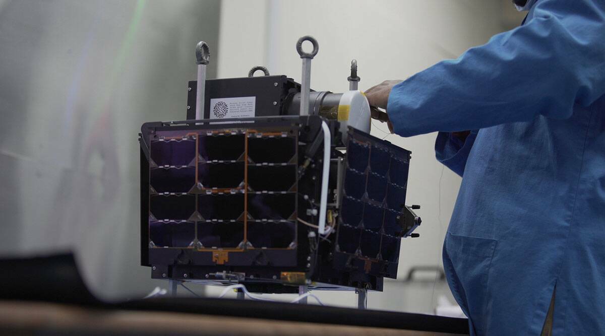
It is anticipated that Pixxel, a Bengaluru-based start-up, will launch Anand, its third hyperspectral satellite, into space on November 26. During the launch, the Polar Satellite Launch Vehicle (PSLV) of the Indian Space Research Organisation (ISRO) will be used. It is the first time that the company is conducting a launch from Indian soil. Several demonstration satellites, “Iteration-1” and “Iteration-2,” have already been launched with SpaceX Falcon-9 rockets from Cape Canaveral in the United States. Pixxel focuses on building hyperspectral imaging satellites that can help capture rich and detailed images.
Awais Ahmed, the company’s co-founder, told indianexpress.com that Anand weighs less than 15 kilograms and can sustain more than 150 wavelengths. It is possible to detect gasses, methane leaks, underground oil, pest infestations, and crop diseases early on with the satellite, which was not possible with existing multispectral satellites. During Ahmed’s time at the Birla Institute of Technology and Science (BITS), Pilani, he co-founded the company with his classmate Kshitij Khandelwal.

What is hyperspectral imaging?
From space, three types of imaging can be performed: red-green-blue imaging, multispectral imaging, and hyperspectral imaging. It is possible to capture data using hyperspectral imaging at hundreds of wavelengths. Throughout the electromagnetic spectrum, it gathers and analyzes data.
An image of a scene using hyperspectral imaging consists of a spectrum for each pixel present in the image. This type of imaging can be used to discover objects, and identify materials in an image, which might not be possible in traditional red-green-blue imaging.

As an example, hyperspectral imaging can provide information regarding the nutrients present in soil. In addition to its potential use in the environmental sector, the technology may also find application in the detection of oil spills and gas leaks.
Pixxel is also developing a plan to process the data derived from the hyperspectral imaging done by the three satellites. The company is also planning to reach out to potential customers in the agriculture, oil and gas mining sectors and governments worldwide. In addition, the company intends to develop a software platform that will allow users to download hyperspectral imaging satellite data, which can then be analyzed further.
The ultimate goal is to launch a constellation of 24 hyperspectral satellites and build a complete hyperspectral constellation. A launch timeline of mid-2023 is anticipated for Pixxel’s first six devices, which are currently being tested at its Bangalore facilities. Pixxel can guarantee global coverage of its hyperspectral image satellites by using such a constellation.